Key points
- NOAA’s Okeanos Explorer mapped 24,253 square kilometers (9,364 square miles) within the Cook Islands exclusive economic zone during the first leg of the 2026 Cook Islands ROV Exploration cruise.
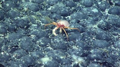
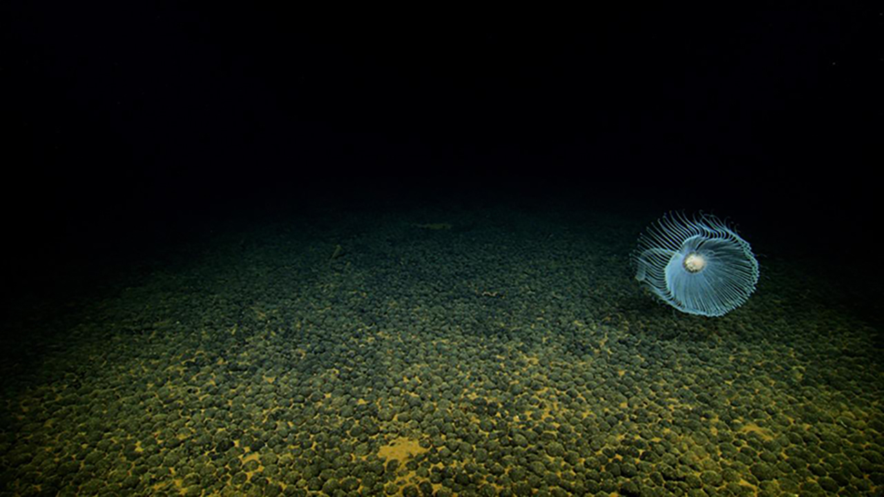
- Scientists observed polymetallic nodules on the seafloor at seven dive locations, mostly in areas with little or no prior data.
- The team collected polymetallic nodules, sediment, water and biological samples, including an octocoral and a carnivorous sponge, for chemical and environmental DNA analysis.
- The cruise is a permitted scientific mapping activity conducted with the Cook Islands Seabed Minerals Authority and does not authorize commercial seabed minerals harvesting.
2026 Cook Islands ROV Exploration
Marine Critical Minerals in the Cook Islands: A Preliminary Look
The Cook Islands is endowed with seabed resources within its vast ocean territory. Scattered across the seafloor within the island nation’s territorial waters are found dense polymetallic nodules of varying sizes, many of which may contain critical minerals that are increasingly important for new and developing technologies. During the first leg of the [2026 Cook Islands ROV Exploration](/expedition/ex2605/) cruise, scientists from the United States and the Cook Islands came together to map and explore Cook Islands’ deep waters using NOAA’s highly specialized research ship and remotely operated vehicles (ROVs). The team aboard NOAA Ship Okeanos Explorer mapped 24,253 square kilometers (9,364 square miles) within the Cook Islands exclusive economic zone and collected polymetallic nodules, sediment samples, representative biological samples such as an octocoral and a carnivorous sponge, and water samples for [environmental DNA](/technology/edna/) and chemical analyses. NOAA is working with the Cook Islands to piece together where, why, and how marine critical minerals in polymetallic nodules form and are found as well as the environmental context in which they occur.
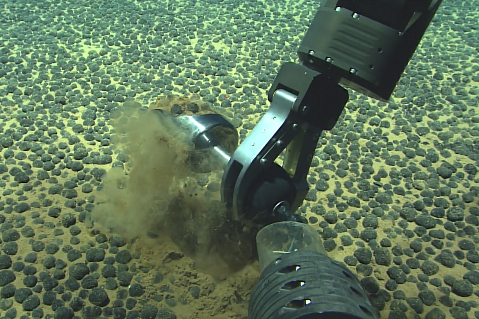
While initial research has confirmed the presence of polymetallic nodules in the areas explored, further scientific study is needed to better understand their resource potential and the marine environments in which they occur. Data collected during the cruise will be further studied to understand the interaction between marine life and the surrounding environment in the area, informing responsible management practices for ocean resources in the Cook Islands exclusive economic zone. This science-based approach undertaken by NOAA and the Cook Islands Seabed Minerals Authority will help ensure that any future decisions regarding seabed minerals are guided by robust evidence, environmental responsibility, and long-term benefits for the people of the Cook Islands.
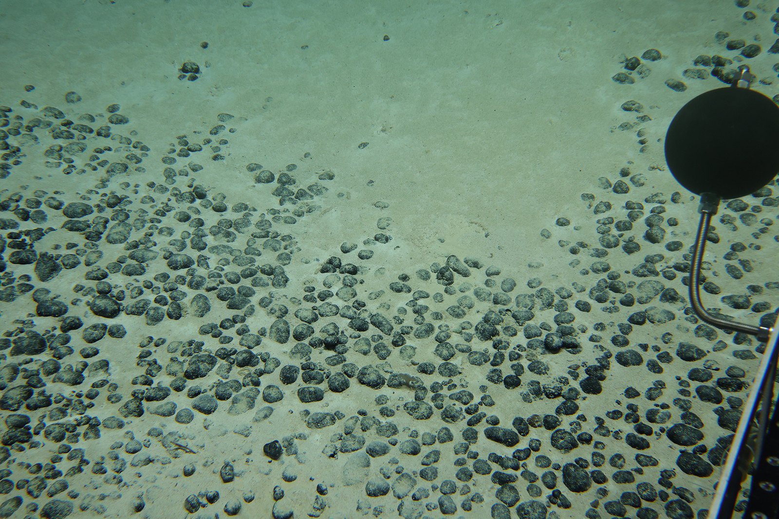
Marine critical minerals are minerals found on the ocean floor that are essential to a nation’s economy and security. These minerals are used in everyday devices like cellphones and cars, but they aren’t easy to come by. Depleting mineral deposits on land, advanced deep-sea technologies, and increasing demand for these materials mean that more attention is being given to critical minerals in marine environments. While we know that seabed minerals occur in every ocean basin in the world, including within U.S. waters, we are still lacking much of the data needed to determine which locations have economically significant mineral concentrations.
Based on the notion that we can’t manage what we have yet to discover, data collected during mapping and exploration missions like the 2026 Cook Islands ROV Exploration cruise deliver the best available science to local decision makers, ensuring they have the information they need about mineral resources and the environments in which they are found.
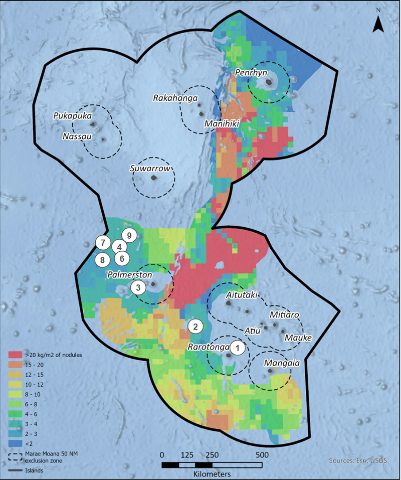
During the first leg of the 2026 Cook Islands ROV Exploration cruise, we saw polymetallic nodules on the seafloor at seven dive locations. As shown in the map below, these dives took place in areas where little or no prior data existed. With the data being gathered during the cruise on Okeanos Explorer, the Cook Islands Seabed Minerals Authority will be able to update their resource potential model to include additional potential mineral areas.
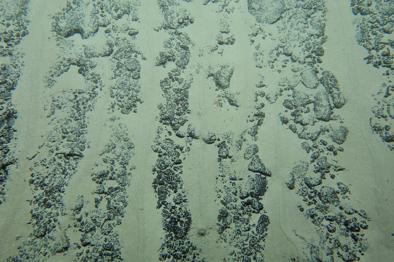
While additional analyses will need to be done on the collected samples and data for more final conclusions, preliminary findings from the first half of the cruise have already expanded our understanding of marine critical minerals in the western Cook Islands, which was previously largely unstudied. Looking at the seafloor mapping data, ROV imagery, water chemistry, and the chemistry of collected polymetallic nodules can help us better understand how, why, and where marine critical minerals form in the Cook Islands, allowing the Cook Islands to make decisions on how to manage these important resources.
This collaborative science initiative reflects a shared commitment to advancing scientific knowledge of marine critical minerals and the marine environments in which they occur. Through collaboration and the exchange of expertise, both countries are strengthening the evidence base needed to inform future decisions, support responsible resource management, and better understand the opportunities and challenges associated with marine critical minerals. This partnership underscores the importance of science, service, stewardship, and cooperation in exploring the potential of marine resources for the benefit of future generations.

The cruise is a permitted scientific exploration and mapping activity that supports the Cook Islands’ understanding of its deep ocean. It will help build baseline knowledge of areas that remain difficult to access and not well understood. The cruise does not authorize commercial seabed minerals harvesting and does not replace Cook Islands law, public process, or environmental safeguards.