Key points
- USGS collected box cores in the Samoa Basin on leg three of the American Samoa Mapping Project, an interagency survey led by NOAA in partnership with BOEM.
- Thirty-eight box cores were deployed between April 13 and April 28, 2026, and 36 recovered enough material to determine nodule density.
- Thirty-five cores yielded enough material for subcores for further analysis; USGS directed the sampling locations and processed the cores shipboard.
- The published report is an expedition summary with preliminary datasets, with further data releases and publications to follow.
On leg three of the American Samoa Mapping Project, an interagency-supported hydrograph survey project led by NOAA and in partnership with BOEM, USGS collected box cores and interdisciplinary datasets to inform prospectivity analyses throughout the region.
USGS scientists led a box coring effort to the Samoa Basin, in order to characterize minerals and the surrounding abyssal sediments and fauna. Thirty-eight box cores were deployed between April 13, 2026 and April 28, 2026. Thirty-six box cores recovered some amount of sediment material, with 36 recovering sufficient material to determine nodule density, and 35 recovering sufficient material for subcores to be collected for further analysis.
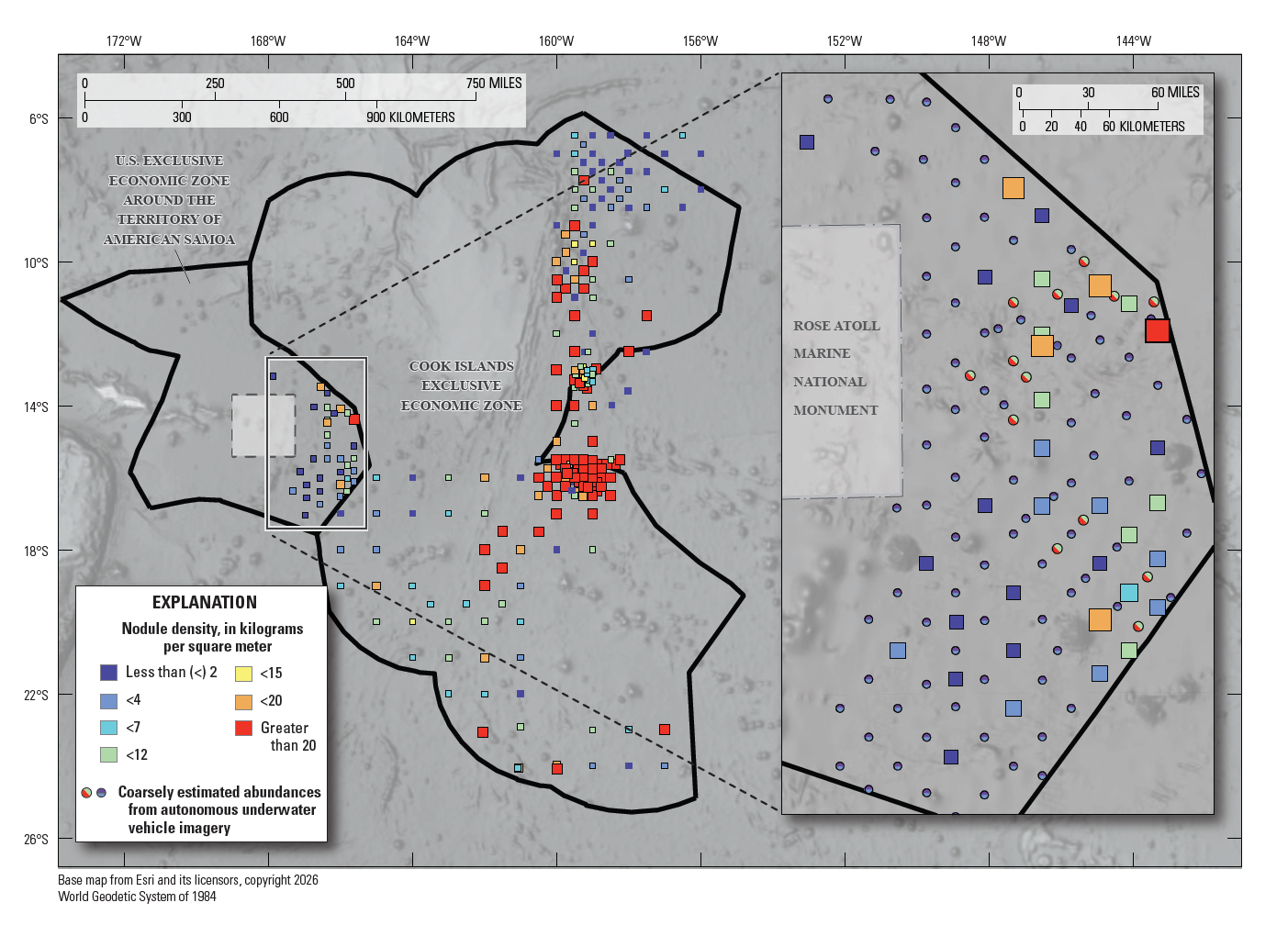
USGS personnel directed the sampling locations and took custody of the box cores once recovered shipboard. USGS personnel then photographed and described the cores, subsampled, conducted analyses including wet weights and time sensitive measurements, and preserved subsamples and additional components for future work. This report is an expedition summary with preliminary datasets; remaining data releases and publications will be forthcoming.
Read the report: Samoa Basin Abyssal Mapping: Box Coring Leg